Update on potential weekend snow

With the latest forecast models out, the weather geeks are now saying this weekend snow is looking more to be on the lighter side. This is good news for travelers, not so good news for sledders!

…LATEST MODEL GUIDANCE IS TRENDING TOWARD A LESS SIGNIFICANT WINTER STORM FOR CENTRAL NORTH CAROLINA ON SATURDAY THROUGH SUNDAY…. TWO DIFFERENT MECHANISMS ARE EXPECTED TO PRODUCE SOME WINTRY PRECIPITATION ACROSS CENTRAL NORTH CAROLINA THROUGH SUNDAY. THE FIRST AND WEAKER SYSTEM IS A MID LEVEL DISTURBANCE ASSOCIATED WITH A SHORT WAVE IN THE NORTHERN STREAM THAT MOVES INTO THE OHIO VALLEY/SOUTH APPALACHIANS ON SATURDAY. THE OTHER AND POTENTIALLY MORE SIGNIFICANT SYSTEM IS A SURFACE LOW THAT DEVELOPS IN THE GULF OF MEXICO ON SATURDAY AND THEM MOVES UP THE EAST COAST SATURDAY NIGHT/SUNDAY.
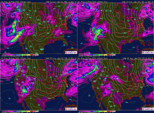
via National Weather Service Text Product Display.

White Christmas on the way?

White Christmas?

Our weather forecast is calling for a significant chance of snow on Christmas Day in Raleigh. Currently the forecast shows a 60% chance of snow the afternoon and evening of Christmas Day. My forecaster friend Jeff Orrock says this snow could be significant.

We could be looking at a White Christmas and then some. Stay tuned!

A STORM SYSTEM WILL TRACK ACROSS THE DEEP SOUTH CHRISTMAS DAY…BEFORE MAKING A TURN TO THE NORTHEAST AND MOVING ALONG THE SOUTHEAST AND MID ATLANTIC COAST CHRISTMAS NIGHT AND SUNDAY. WHILE THERE REMAINS CONSIDERABLE UNCERTAINTY AS TO THE EXACT TRACK AND TIMING OF THIS STORM…CONFIDENCE IS INCREASING THAT CENTRAL NORTH CAROLINA WILL SEE ACCUMULATING SNOWFALL.

via National Weather Service Watch Warning Advisory Summary.

Update 10:30 AM: News14 meterologist Lee Ringer says this storm has major potential, though the track and timing are not certain. Adjust your travel plans accordingly!

While a lot of folks are dreaming of a white Christmas, this storm has the potential to become a major snowstorm from the Carolinas to the northeast. This would create dangerous or impossible travel conditions.

Murphy’s Law week

Well it’s been an interesting week so far. Sunday afternoon the hard drive in our home mail server decided to crash, leaving us without email for two days. I noticed it Monday morning when I had a conference call of several hours, too. I spent Monday morning scrambling to get everything fixed while on the phone with customers, trying to demonstrate our product. It was a total zoo but somehow I made it.
Continue reading

Weather online again

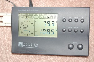
MT.Net weather station file photo

Well, it took me about a year after I set up my weather station in our current house before I actually connected it to the outside world but last night I got around to it. Seeing Travis’s taped-up toy weather station sitting sadly in yesterday’s rain got me motivated to give the kids some weather graphs and statistics to check whenever they want.

Now anyone can check the weather in East Raleigh by clicking on this link. Weather information updates every 10 minutes “on the elevens.” I still have to repair my wind speed gauge but everything else is working. Eventually I hope to upgrade to wireless (and solar) instruments I can mount above the roof but this will work for now.

Power outage

We had a power outage this evening from 8:30 to 10:00 PM. Afterward our home fileserver did not boot, so personal email accounts and home phone are temporarily down. Hopefully I can get things straightened out Monday. The server issue is with the motherboard and/or (more likely) the power supply. The drives should be fine so I don’t expect any data loss.

The power failure took the opportunity to interrupt my breadmaking. I had kicked off a new flavor, Italian wheat, only to have the power pull the plug on it after 90 minutes. It was a short blip but enough to knock the breadmaker out of its cycle. Fortunately, I found another cycle that heads to the bake cycle relatively quickly and got it going again. Then the power failed again, this time for the 90 minute outage. I still would not give up on my bread, though, and resumed baking it after the power returned. Against all odds it turned out great!
Continue reading

Summer’s over

The sun went down this evening on the last day of summer, 2010. I can’t say I’ll miss it, though I was so looking forward to it when we were in the midst of one of our coldest winters here last winter. So we went from the 6th coldest winter ever to the hottest summer ever. That’s crazy.

We went to lots of swim meets, went on a few greenway rides, spent time at the pool, took a long weekend at the beach, went sailing all of one time, but if you asked me if we made the most of the summer I would have a tough time answering that. The oppressive heat really wasn’t fun, and given a sunny but hot day we would most likely lie low. It’s tough to get motivated to do something outside when one’s energy is sapped the moment one steps out the door.

So bring on fall, I say. Cooler weather means more outdoor activity. Fewer mosquitoes. It also means one of the most beautiful times of year to be in North Carolina. I love it, and look forward to a nice fall season.

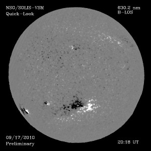
Sayonora, sunspots?

A recent report says that our sun is not kicking out sunspots like it used to. The paper, by solar astronomers Matthew Penn and William Livingstone, says that the magnetic field strength of the sunspots appears to be waning.

If the trend continues, sunspots could vanish completely by 2016. The last time this happened there was a prolonged cooling spell on Earth, known as the Little Ice Age.

It will be interesting to see what, if anything, comes of this.

Hurricane season is like Russian roulette

Not long after North Carolinians stopped worrying about Hurricane Earl we’ve got more fun lining up in the Atlantic. Hurricane Igor has grown to a strong storm with 140 MPH winds at the moment. Igor is bearing down on North Carolina as of now, though it will be a week or so before it reaches its closest approach. Most likely it will be pushed aside the way Earl was by the high pressure sitting over us.

Following Igor is “Tropical Depression Twelve,” which is expected to become a tropical storm very soon. Life near the Atlantic is always full of excitement!

Fall-like fun

After yet another few high-90s days earlier this week we’ve had two days of absolutely gorgeous weather. Hurricane Earl was rebuffed by a dry cold front that moved through. The temperature Friday was 98 degrees at one point but the relative humidity was a scandalously-low 19%! The weekend temperatures were about 8-10 degrees cooler with the same low humidity, which is a tantalizing taste of fall (though falls are cooler yet).

We spent most of Saturday just getting some yardwork done. Mowing, weeding, trimming, and leaf blowing were all carried out under sunny skies. Then there was music practice and other fun tasks until dinner. After dinner, we joined our neighbors on the driveway for beer and roasted marshmallows. One of our neighbors across the street got married yesterday and they held their reception in their backyard. We enjoyed people-watching and listening to the 80s-era wedding dance tunes.
Continue reading