It’s pretty amazing to see an earthquake’s effects captured in one GIF.
Millions felt the shaking from the Ridgecrest earthquake.
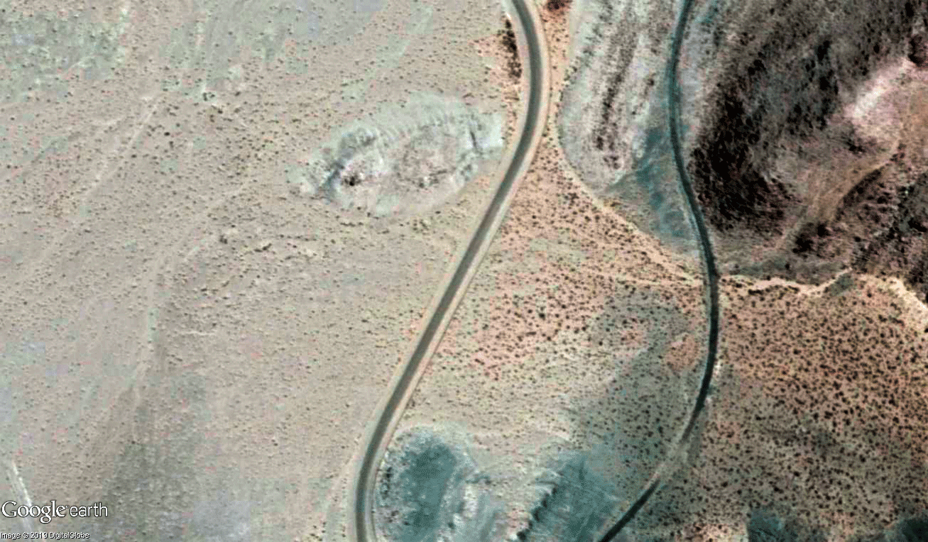
But new satellite images offer a dramatic and instructive view of the immense power of the magnitude 7.1 quake, showing how California’s biggest earthquake in nearly two decades caused the ground to break.Animated slides show how the quake permanently jolted a huge block of earth northwest while the other side of the fault moved southeast.
Some of the clearest images show long scars on the surface of the Mojave Desert, indicating precisely the 30 miles of earthquake fault — oriented in a northwest-southeast direction — that moved within moments on July 5.
“I’ve never seen this before,” said Brian Olson, engineering geologist with the California Geological Survey. “It’s really dramatic and a super-good illustrator, even for the advanced scientists, all the way down to the grade-school kids.”